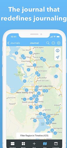
Hey Logseq-Team, think about adding the feature to add the current location to the journal entry in combination with a great map view, like the app day one did it (screenshot below). Would love it a lot ![]()
Map integration could be made even more general to allow collecting any locations. This would let us e.g. collect points of interest.
Find an interesting place, museum etc. Copy and paste google maps page into Logseq, mark as /todo!
- Logseg recognizes links from google maps, OSM etc. and direct coordinates with a latlon command (as a property?)
- /maphere inserts link to current position as you suggested
- Mapview displays map with icons for each item with block title and block content on hovering.
Great suggestions!
What I personally also love while using the app day one is, that I can filter my notes by location clusters (see screenshot above). This really is a big one for me personally and a great way for me to explore (log-)notes. Actually, it’s the only reason why I have to use the day one app anymore at the moment.
Is there a mechanism for a smart paste, i.e. to run arbitrary substitutions when pasting text?
This would make it easy to automatically identify certain links, such as maps:
https://www.google.com/maps/place/The+White+House/@38.8979696,-77.0367791,17z/data=!3m1!5s0x89b7b7bce13fc169:0xb825fceceddb4d3c!4m8!1m2!3m1!2sThe+White+House!3m4!1s0x89b7b7bcdecbb1df:0x715969d86d0b76bf!8m2!3d38.8976763!4d-77.0365298
Logseq could automatically turn this into a block
# The White House
location:: (38.8979696,-77.0367791)
[Google Maps]([linkurl](https://www.google.com/maps/place/The+White+House/@38.8979696,-77.0367791,17z/data=!3m1!5s0x89b7b7bce13fc169:0xb825fceceddb4d3c!4m8!1m2!3m1!2sThe+White+House!3m4!1s0x89b7b7bcdecbb1df:0x715969d86d0b76bf!8m2!3d38.8976763!4d-77.0365298))
... screenshot of the maps link as an offline image ...
similarly /locationhere would create a property with the current location.
On the mapping side, I would suggest to use OsmAnd for display. It doesn’t upload the locations to the cloud, is open source and privacy preserving, with the additional advantage that it will work offline.
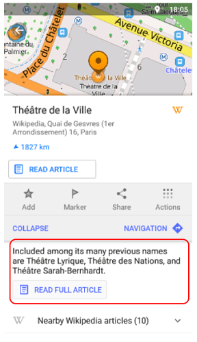
OsmAnd has a feature to display points of interest, their title, and a longer html text body.
OsmAnd can even import all locations from Wikipedia, so dealing with the output from Logseq should be easy.
If Logseq had a feature to export all locations as a gpx file this would work out of the box without a need to add offline mapping to Logseq.

